RS/GIS Python Package
Remote Sensing, GIS, Python, GDAL
Package pyFire written in Python for fire analysis. It provides:
- GIS functions e.g. reprojection, vector masking, area cacluation, and scripts for handling MODIS data;
- statistic analysis e.g. quantile regression, seasonality decomposition and correlation plots;
- classes for handling Community Earth System Model landsurface data and modeling vegetation growth.
This package relies on GDAL.
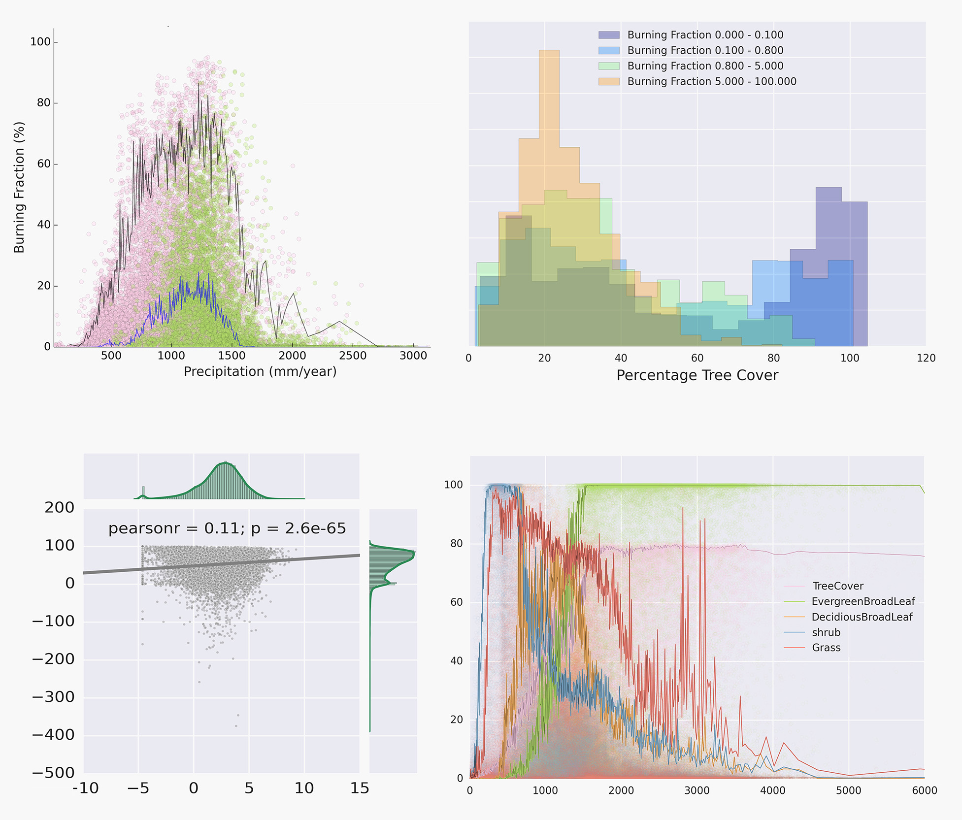
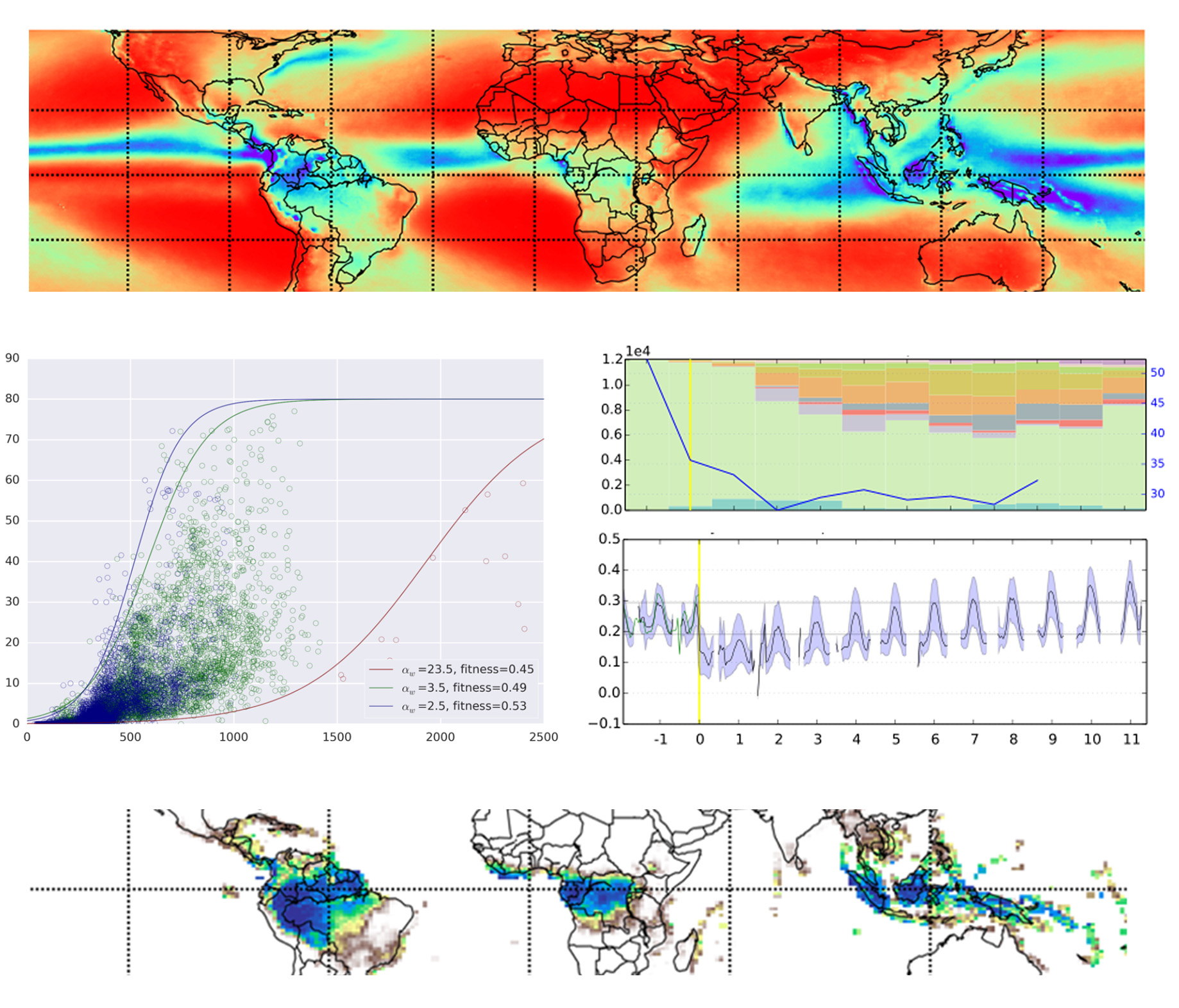
Fire in Earth System
Remote Sensing, Vegetation Ecology, Climate Model
This project models the role of fire in Earth System. Datasets of fire, population, grazing and treecover are used to model the relationship between fire and vegetation growth. The result is then used to force the Community Earth System Model, an Earth system model developed at National Center for Atmospheric Research. Manuscripts under perparation.
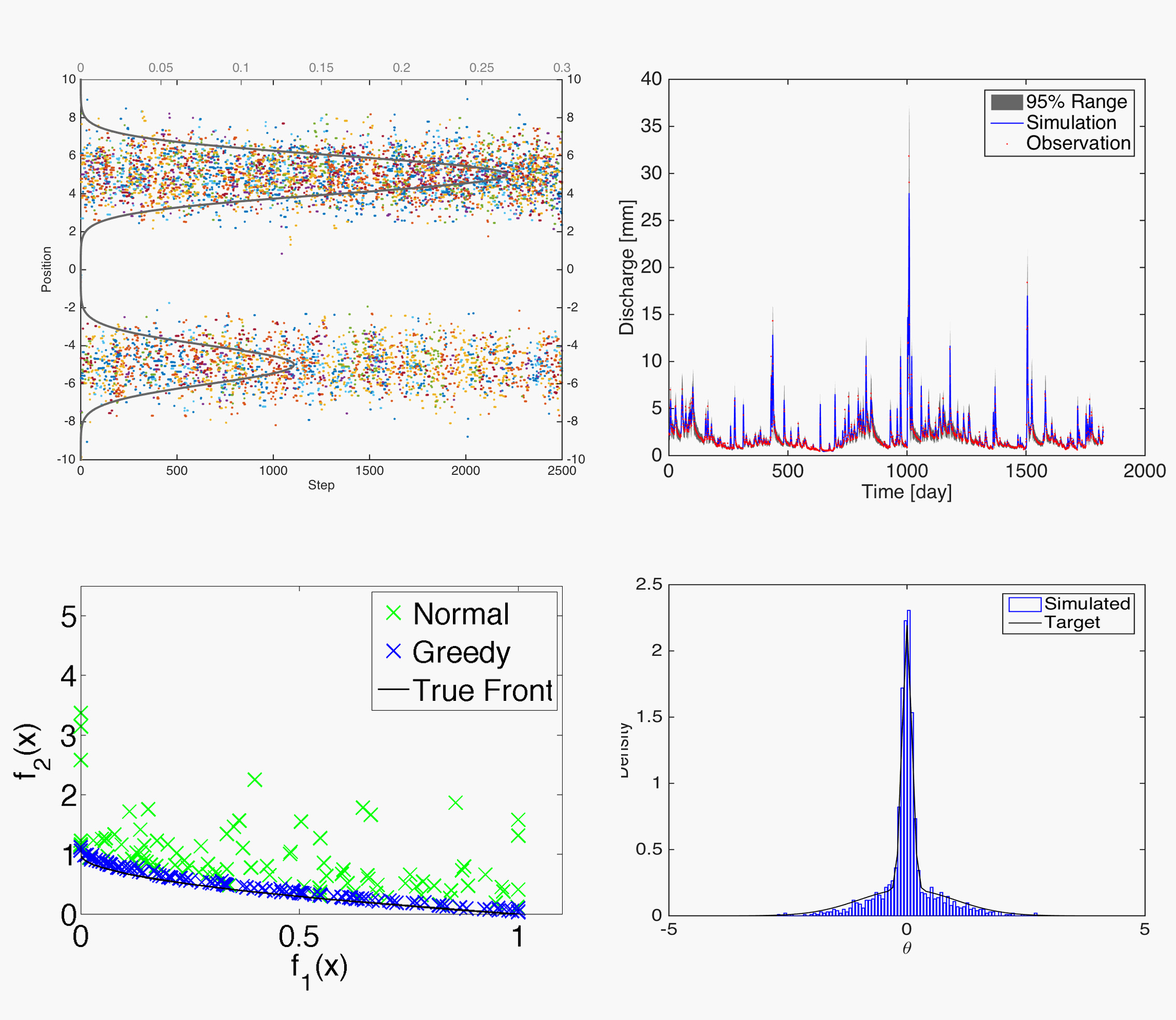
Model Optimization Package
Model Optimization, Data Assimilation, Bayesian Statistics
A package of basic model optimization tools written in Matlab. Includes functions for combining and testing MCMC, Differential Evolution Markov Chain, Ensemble Kalman filter, Approximate Bayesian Computing-Population Monte Carlo, and multiple model averaging methods. Figures shown here are analyses performed by this package.
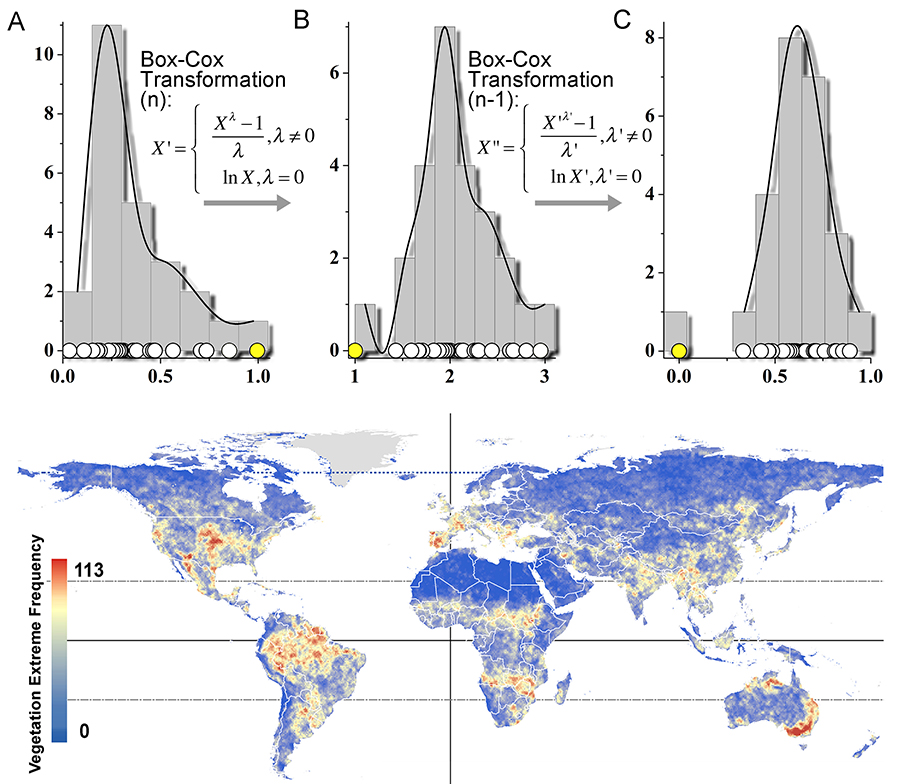
Global Vegetation Vulnerability
Extremes Detection, Vegetation Remote Sensing
I created an extreme detection method using Boc-Cox transformation and Student’s t-test, and applied it to vegetation index from MODIS satellite data. This resulted in a global map of vegetation vulnerability for year 1982-2006.
Published in Environmental Research Letters 8.2 (2013): 025009.
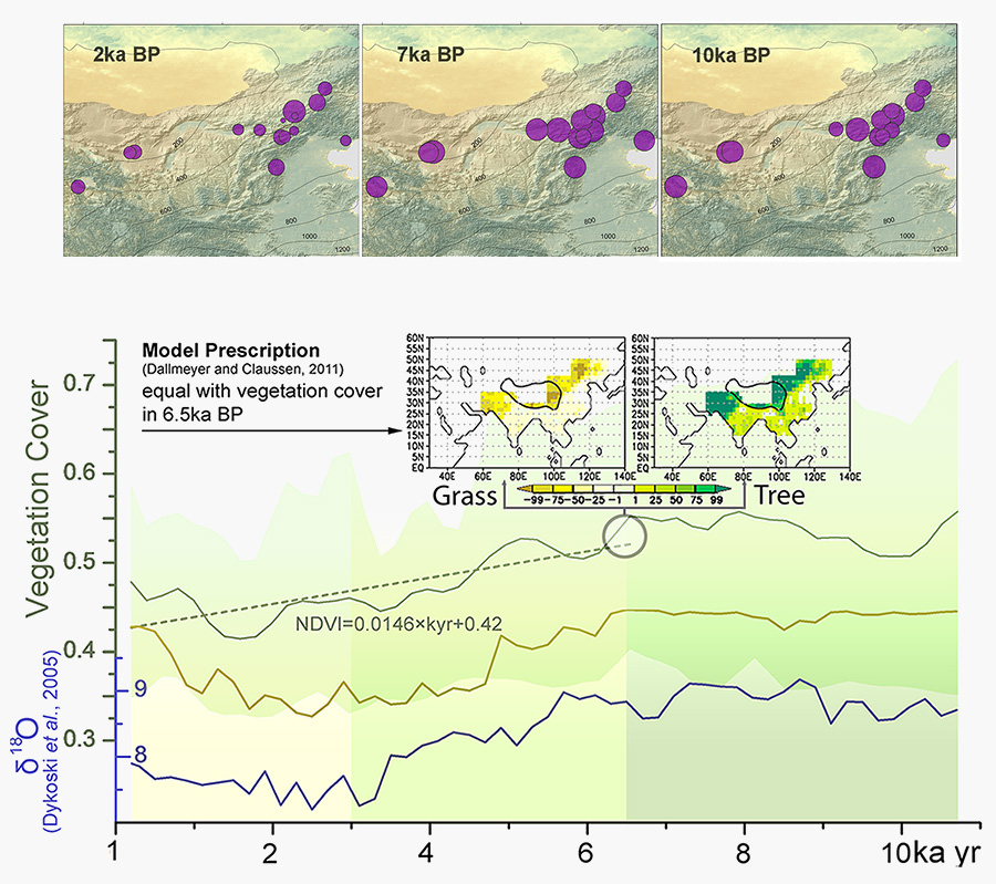
Climate-Vegetation Feedback
Evidence from Millennial-Scale Records
Artificial Neural Network, Deforestation, Paleo-Ecology, Climate Feedback
I used artificial neural network to reconstruct past vegetation at Northern China, then used cross-correlation and partial correlation to eliminate controling factors. The result indicates that the forest die-back in Northern China cooled down the local climate.
Published in PloS one 8.8 (2013): e71681.